Community & Lifestyle · Outdoor Recreation
Rail-trails and the small-town comeback along old railroad grades
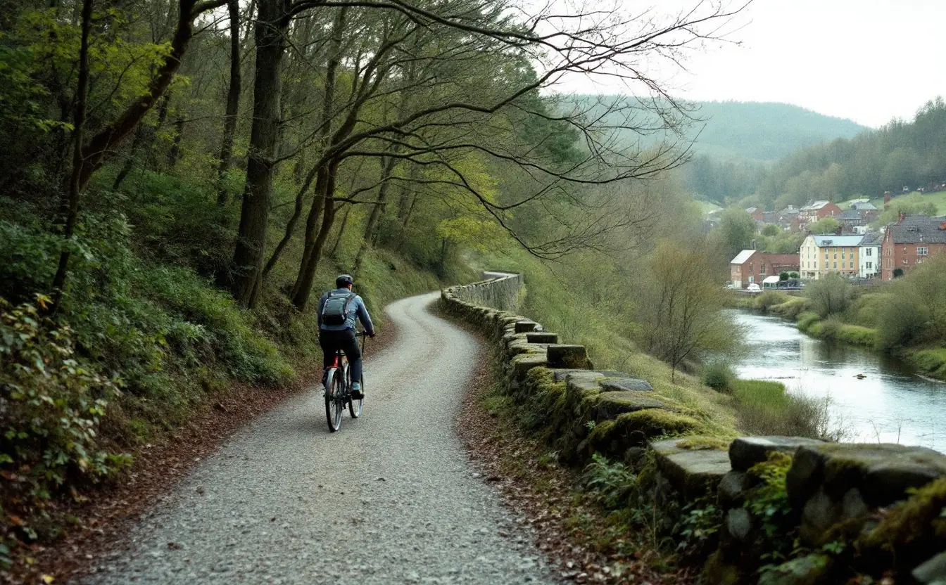
There's a particular moment on a long rail-trail day that I've come to love. The light goes low, the crushed stone turns the color of honey, your legs have settled into that steady, slightly dazed rhythm, and then the trees open up and there's a town: a brick depot, a water tower, a café with bikes leaning three deep against the porch rail. You coast the last quarter mile without pedaling, because the old grade is built that way, and the first cold drink tastes like a prize.
Those towns are there for a reason. Railroads built many of them, or at least made them, and when the trains stopped running, a lot of those places lost the thing that tied them to the rest of the country. Now some of them are being stitched back to the map by the same corridor, only this time the traffic moves at twelve miles an hour and stops for pie.
From rails to trails
Over the twentieth century, as freight shifted to trucks and railroads merged and trimmed their networks, thousands of miles of track fell out of use. Some corridors were sold off piece by piece to neighboring landowners, and once that happens a continuous route is close to impossible to put back together. Others sat abandoned, ties rotting, ballast sprouting sumac and locust.
Wisconsin's Elroy-Sparta State Trail, opened in the 1960s with three old railroad tunnels along its length, is often cited as the first rail-trail in the country. The idea spread slowly at first. A big push came from a 1983 amendment to the National Trails System Act that created what's called railbanking: a rail corridor can be held intact for possible future train service while serving as a trail in the meantime. That arrangement has saved a great many corridors from being broken up, and it has also produced its share of courtroom fights with adjacent landowners who expected the land to revert to them.
Railroads make terrific trail routes almost by accident. Trains hate hills, so grades are gentle, and engineers followed rivers through mountain gaps, so the scenery tends to be good. Bridges and tunnels were built to last. And because steam locomotives needed frequent water and coal, railroads stopped at towns every few miles, which means a rail-trail strings settlements together like beads. A walker or rider is never far from the next one.
Where it has caught on
The Great Allegheny Passage runs about 150 miles from Pittsburgh to Cumberland, Maryland, on old railroad grades, crossing the Eastern Continental Divide and passing through the Big Savage Tunnel. At Cumberland it meets the towpath of the C&O Canal, which continues more than 180 miles to Washington, D.C., so you can ride from the Three Rivers to the Potomac almost entirely off roads. Towns along the way, places like Ohiopyle, Confluence and Meyersdale, have built a good deal of their recent life around the people pedaling through. The phrase "trail town" got much of its traction here.
Farther south, the Virginia Creeper Trail drops roughly 34 miles from the high country near Whitetop through Damascus, Virginia, to Abingdon. Its upper half is a long, gentle descent, and a whole small economy of shuttles and bike rentals has grown up around carrying riders to the top so they can coast down. Damascus, where the Appalachian Trail also passes through, calls itself "Trail Town USA" and works hard to earn it.
Out west and in the middle of the country the pattern repeats. Missouri's Katy Trail, one of the longest continuous rail-trails in the U.S. at roughly 240 miles, follows the Missouri River past bluffs, farm fields and river towns that have added inns, cafés and bike shops. The Route of the Hiawatha on the Idaho-Montana line runs through long, pitch-black tunnels and over high steel trestles in the Bitterroots. In West Virginia, the Greenbrier River Trail follows its river for close to 80 miles through country remote enough that some stretches feel like a wilderness ride.
What makes a trail town work
Spend enough nights in trail towns and you start to see what separates the ones that come alive from the ones where riders roll straight through. It isn't size. Some of the friendliest stops I know are a handful of blocks long.
The trail has to touch Main Street. When the trailhead sits a mile outside town behind a gravel lot, people don't wander in. When a clear, signed connection leads from the trail to a downtown with bike racks, water and a restroom, they do. The best towns treat that connection as their front door.
Hours matter more than anyone expects. Trail users keep odd schedules: early starts, late arrivals, hungry at three in the afternoon, wanting breakfast at six. A town where the only diner closes at two, and stays closed Mondays, loses a lot of riders' money to the granola bar in their handlebar bag. Lodging that welcomes muddy bikes, a laundromat, a campsite with a shower, a shop that can true a wheel or sell a tube: none of it is glamorous, and all of it decides whether someone stays the night.
Economic studies commissioned along several long trails have generally found visitors spending real money in the towns they pass through. The methods differ from study to study, though, and I'd treat any single dollar figure with caution. What I can say from the saddle is that a busy weekend on a popular trail fills porches and parking spaces in a way you can see.
The honest caveats
A trail isn't a factory, and it doesn't replace one. The work it brings is seasonal, often part-time, and tied to weather. A string of rainy summer weekends hits the café hard. Some towns along famous trails have seen rising rents and houses turned into short-term rentals, which brings its own tensions for people who lived there long before anyone came through on a bike.
Old rail grades along rivers also flood, sometimes badly, and washed-out sections and damaged bridges cost serious money to repair. Maintenance in general falls on a patchwork of state parks, counties and volunteer groups, and a trail with no one minding it goes back to brush faster than you'd think. Neighbors sometimes oppose a new trail out of worry about trespassing or crime. In my experience a fair number of the early skeptics end up walking their dogs on it, but those worries deserve a real hearing rather than a brush-off.
Still, I've ridden into enough towns where the hardware store now sells inner tubes and the old depot has a coffee counter to believe the comeback is real wherever people work at it. It just isn't automatic.
Before you ride: a rail-trail checklist
Long rail-trails look easy on the map, and the grades usually are. The logistics are where people come unstuck. Run through this before you go.
- Check the surface. Paved, crushed limestone, cinders or rough ballast all ride differently. Crushed stone softens after rain, and wider tires make life far more pleasant on it.
- Check closures and seasons. Some long tunnels close for winter, including the Big Savage Tunnel on the Great Allegheny Passage, and floods or bridge work can shut sections without much notice. Look at the managing park or trail group's current page.
- Bring real lights. Even short tunnels are dark at midday, and the long ones are black, cold and dripping. A front light and a rear light, both charged.
- Map water, food and hours. Services can be many miles apart, and small-town shops often close early or on set weekdays. Know where the next open kitchen is.
- Plan for no signal. River gorges and hollows swallow cell coverage. Download maps ahead of time and tell someone your plan.
- Pack a repair kit. Spare tube, pump, tire levers and a multi-tool. Bike shops can be a long day apart.
- Sort the shuttle. For one-way rides, book shuttles and lodging early on popular weekends, especially in peak foliage season.
- Ride like a neighbor. Bell or a friendly call before passing, pass on the left, slow for walkers and kids, and yield to horses where they're allowed.
- Watch the crossings. Road crossings were laid out for trains, not bikes, and sightlines can be poor. Stop and look.
- Check the river. If the trail follows a river, glance at the forecast and the nearest stream gauge; our guide to reading a stream gauge explains what the numbers mean.
- Spend money in town. Eat lunch on Main Street, buy the tube at the local shop, stay the night if you can. That's the whole point.
If you're timing a trip for color, the gentle grades and river valleys of most rail-trails make them a fine way to follow fall color by elevation. For other ideas about how trails, towns and the outdoors fit together, browse our community and lifestyle writing. For the C&O Canal towpath, the National Park Service keeps current conditions on its C&O Canal park page.
And when you roll into town at the end of the day, lean the bike against the porch rail with the others, order the biggest thing on the menu, and ask whoever's behind the counter where the old depot used to stand. Somebody always knows.
Hollow & Headwater is an independent publication. Nothing here is official guidance – for permits, rules or emergencies, go to the relevant public authority.