Air & Climate · Science & Explainers
Flash floods in steep terrain, explained: rain, rock and runoff
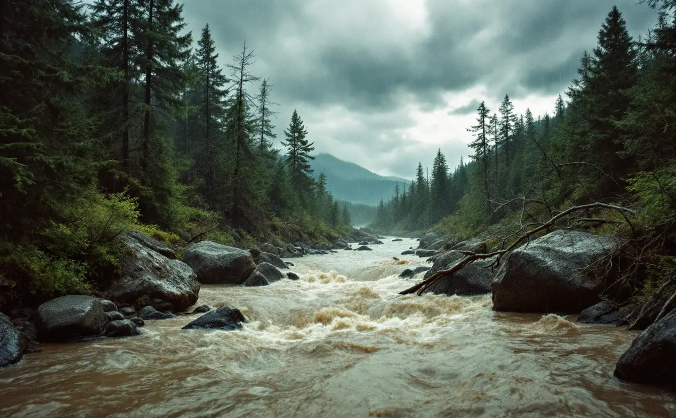
A creek in a steep hollow can go from ankle-deep and clear to a brown, roaring wall of water in less time than it takes to cook dinner. People who live in mountain country know this in their bones. People visiting for a weekend of camping or canyon hiking often don't, which is one reason flash floods catch so many of them off guard.
I spent years babysitting air-sampling instruments for a university atmospheric chemistry group, a job that teaches you to watch the sky closely, and the lesson that stuck hardest is that the sky only supplies half of a flash flood. The rest comes from the ground: its slope, its soil, its shape. Put intense rain on the wrong kind of terrain and the result is less like a rising river and more like someone pulling the plug on a bathtub perched above your head.
What counts as a flash flood
The National Weather Service describes a flash flood as flooding that begins within six hours, and often within three hours, of heavy rainfall, or of a sudden release of water such as a dam or levee failure or a breaking ice jam. Ordinary river flooding is a slower affair. A big river may take days to crest after a storm system, and you can usually watch it coming. A flash flood gives you minutes to an hour or so, sometimes less, and it often arrives in places where it isn't raining hard, or isn't raining at all.
Steep terrain is where flash floods do their worst. Three ingredients line up there more readily than anywhere else.
Ingredient one: rain that comes down hard and stays put
A passing thunderstorm can drop a lot of rain, but if it keeps moving, any one valley gets only a short dousing. Trouble starts when storms stop moving, or when new cells keep forming over the same spot and marching across it one after another. Forecasters call that "training," as in train cars passing a crossing, and it's behind many of the worst flash floods on record.
Mountains help storms stay put. When moist air is pushed against a mountain front, it's forced upward, cools, and wrings out its moisture, a process called orographic lift. That's what happened in Colorado's Big Thompson Canyon in the summer of 1976, when moist air flowing upslope against the Front Range fed storms that sat over the upper canyon for hours. The flood that came down the canyon that night killed well over a hundred people.
Tropical moisture adds fuel. When the remains of a hurricane or tropical storm drift inland, they carry an enormous amount of water vapor, and mountains can squeeze it out with brutal efficiency. The remnants of Hurricane Camille did exactly that over the Blue Ridge in central Virginia in August 1969, setting off overnight flash floods and landslides far from any coast. Forecasters watch a quantity called precipitable water, the total water vapor in a column of air, as one measure of how much a storm has to work with.
Ingredient two: ground that can't drink fast enough
Every soil has an infiltration capacity, a top speed at which it can soak up water. When rain falls faster than that, the extra runs off across the surface. When rain falls on soil that's already full from earlier storms, nearly all of it runs off no matter how gently it falls. Either way, the ground stops being a sponge and starts behaving like a roof.
Mountain soils are often thin, lying over bedrock that takes in very little water, so they fill quickly. Exposed rock sheds rain almost completely. Pavement and compacted ground in narrow valley towns add more. Frozen ground in spring can do the same.
Wildfire changes the equation dramatically. A hot fire strips away the plants and leaf litter that slow water down, and it can leave a water-repellent layer in the soil. On a fresh burn scar, a short burst of intense rain can launch a debris flow, a fast-moving slurry of mud, rock and trees that hits far harder than water alone. In January 2018, debris flows poured off slopes burned by the Thomas Fire into Montecito, California, with deadly results. Across the West, the danger to everything downstream can last for years after the flames are out.
Ingredient three: terrain that funnels
Steep slopes move water fast. Narrow valleys gather it from both sides into a single channel. In much of the Appalachians, the Ozarks and the canyon country of the Southwest, a dense network of small ravines feeds into each hollow, so water from the whole watershed arrives at the bottom almost together. Hydrologists talk about a watershed's "time of concentration," the time it takes for water from the farthest point to reach the outlet. In a small, steep basin, that can be shockingly short.
There's a human piece to this too. In narrow valleys, the only flat ground is often right beside the creek, so that's where the road, the houses and the campground went. The eastern Kentucky floods of late July 2022 struck overnight in exactly this kind of country, when many people were asleep in homes along hollow creeks.
The arithmetic of a small watershed
Here's a piece of engineering math I've always liked, because it explains so much with so little. For small watersheds, engineers estimate peak runoff with what they call the rational method: peak flow equals a runoff coefficient, times rainfall intensity, times drainage area. The runoff coefficient is simply the fraction of rain that runs off instead of soaking in. It runs close to 1 for bare rock or pavement and much lower for deep, healthy forest soil.
There's also a happy accident in the units. One inch of rain per hour falling on one acre works out to almost exactly one cubic foot per second of water, and a cubic foot is about seven and a half gallons. A square mile is 640 acres, so take a hypothetical steep hollow draining two square miles, give it two inches of rain in an hour, and assume only half of it runs off. That's roughly 0.5 × 2 × 1,280, or about 1,280 cubic feet per second, nearly ten thousand gallons every second, coming out of a creek you might normally step across. The real world is messier than one formula, but the order of magnitude is the point.
You can watch this happen on a stream gauge. A graph of flow over time, called a hydrograph, for a small mountain stream after a cloudburst looks like a church steeple: a near-vertical climb, a sharp peak, a quick fall. A big river's hydrograph looks more like a long hill. Our explainer on reading a stream gauge walks through those graphs, and live gauge data is available through the USGS Water Data for the Nation site.
Weather forecasters use a related idea called flash flood guidance: an estimate of how much rain over one, three or six hours would start small streams flooding in a given area. When soils are already soaked, that number drops, sometimes a lot. That's why a modest storm on a wet week can do more damage than a bigger one after a dry spell.
Where steep country sets its traps
- Roads along hollow creeks. The road follows the stream because that's the only route, and at night you can't see whether the water across it is six inches deep or whether the pavement underneath has washed out.
- Low-water crossings and fords. Common in the Ozarks and Texas Hill Country, and fine until they aren't. Water that looks calm can be moving fast.
- Campsites on gravel bars and low terraces. Flat, pretty and right where a flood goes first.
- Slot canyons and dry washes. In the Southwest, a storm miles upstream can send a flood through a canyon under blue sky. It doesn't have to rain where you stand.
- Slopes and channels below burn scars. Even moderate bursts of rain can trigger debris flows for several years after a fire.
What the forecast words mean
These are the main terms the National Weather Service uses, and they're worth knowing cold. Current alerts for any location are on weather.gov.
Flash Flood Watch. Conditions are favorable for flash flooding. It hasn't happened yet. This is the time to rethink the creekside campsite and check your route out.
Flash Flood Warning. Flash flooding is happening or is about to. Move to higher ground now, and don't wait to see the water.
Flash Flood Emergency. A rare, more urgent warning used when a severe threat to life and catastrophic damage from a flash flood are happening or imminent. If you ever see one for where you are, treat it as the real thing.
Staying on the right side of the water
The best-known flood safety phrase in the country is also the most useful: turn around, don't drown. The National Weather Service points out that about six inches of fast-moving water can knock an adult off their feet, about a foot of rushing water can carry away most cars, and two feet can sweep away SUVs and trucks. A large share of flood deaths happen in vehicles, often at night. A few more habits are worth keeping:
- Get up, not out. If water is rising, climb the valley side to higher ground rather than running downstream along the creek.
- Watch the creek. Water that suddenly turns muddy, rises quickly, carries sticks and leaves, or starts to roar is telling you something. So is a stream that suddenly drops while it's still raining, which can mean debris has dammed the channel upstream.
- Check the whole watershed. Before a canyon hike or creek camp, look at the forecast for the higher ground upstream, not just your spot.
- Keep alerts on. Phone weather alerts or a weather radio can wake you, and flash floods love the middle of the night.
- Never drive around barricades. They're there because somebody already saw what's underneath.
For the maps and data tools that show rainfall, gauges and watersheds near you, see our guide to public environmental maps and data. Ten minutes spent finding your nearest upstream gauge before storm season is time well spent.
If you take one image away, make it this: a dry streambed in steep country isn't empty. It's a channel waiting for water, carved by every flood that came through before. When you pitch a tent or park a car, look up the slope and ask where that water would go next time.
Hollow & Headwater is an independent publication. Nothing here is official guidance – for permits, rules or emergencies, go to the relevant public authority.